Solocator
Engineering a Top-20 Navigation Ecosystem for High-Precision Fieldwork
A cross-platform GPS fieldwork platform with real-time metadata overlay, custom GIS exporting, and cloud synchronization.
/ Project Overview
High-Performance Mobile Solution for Location-Critical Industries
Solocator is a high-performance mobile solution designed for industries where location accuracy is non-negotiable. Axiom took the core concept of a GPS camera and engineered it into a robust professional tool used by architects, engineers, and field inspectors worldwide.
The application captures and stamps photos with critical metadata: compass direction, GPS coordinates, altitude, and custom industry notes.
/ The Challenge
Engineering Precision at Scale
The client required a solution that could handle complex data overlays without sacrificing camera performance or battery life.
The main engineering challenge was to ensure that high-frequency data (location, orientation, and altitude) remained perfectly synchronized with the hardware camera shutter across thousands of different Android and iOS device configurations.
As the user base grew, we needed to implement a modular "Industry Pack" for advanced metadata management and cloud-driven data export.
High-Frequency Data
Location, orientation & altitude sync
Cross-Platform
Thousands of device configs
Camera Performance
Zero lag overlay rendering
Cloud Sync
Enterprise data redundancy
/ Our Engineering Solutions
How We Solved It
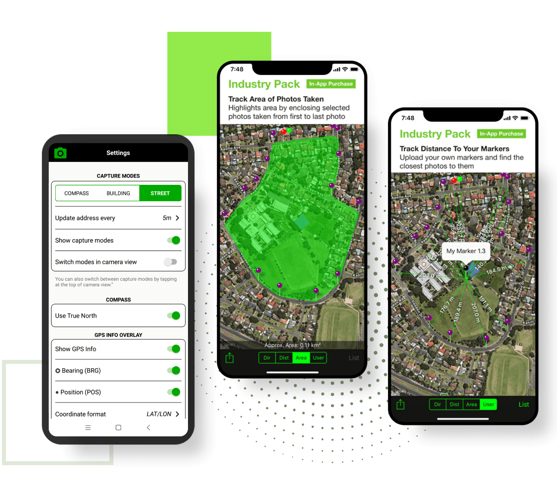
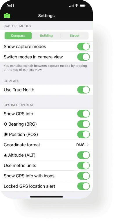
High-Precision Metadata Overlay
We developed a custom camera engine that overlays real-time GIS data (GPS, Compass, Altitude) directly onto the image buffer. Users can customize coordinate formats, metric/imperial units, and layout aesthetics without performance lag.
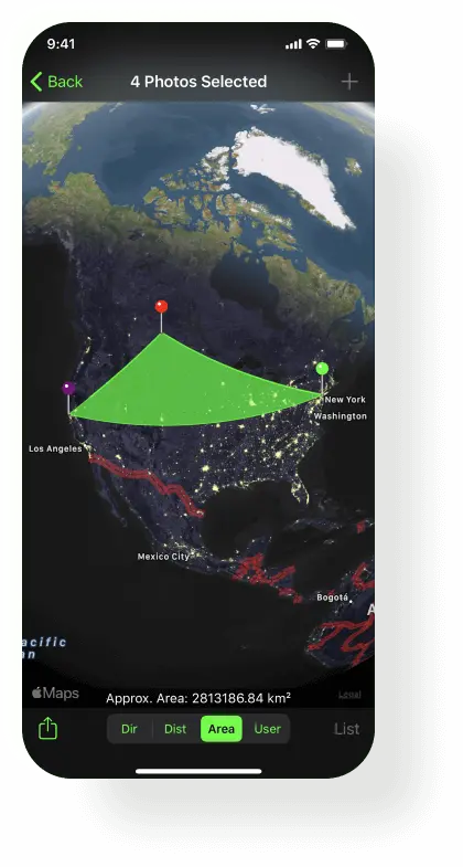
Advanced Data Management & GIS Mapping
Photos are not just stored; they are indexed. We implemented a map-view tracking system where users can visualize photo clusters, directions of capture, and project-based distances.
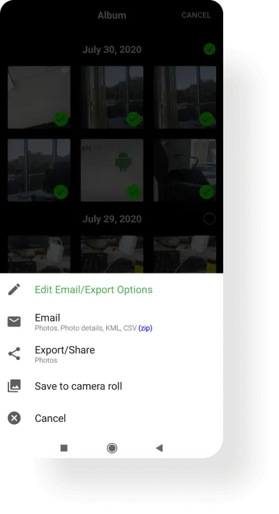
Complex Export & Automation Logic
To support enterprise workflows, we engineered custom export modules for KML, KMZ, and CSV files. We also integrated automated background synchronization with Google Drive, Dropbox, and iCloud, ensuring data redundancy for field workers in remote locations.
Monetization & Scalability
Axiom implemented a secure In-App Purchase (IAP) architecture for the "Industry Pack," allowing for flexible feature unlocking, including street modes, custom overlays, and enhanced GPS filtering.
/ Tech Stack & Expertise
Built for 8+ Years of Longevity
To ensure the longevity of the project (8+ years and counting), we utilized a maintainable and performant stack:
iOS
- Swift
- Objective-C
- CoreLocation
- CoreData
Android
- Kotlin
- Java
- Google Play Services
Web & API
- Vue.js (Admin Portal)
- Custom Cloud Integration
Data Formats
- KML
- KMZ
- CSV
/ The Result
A Global Success Story
Through Axiom's long-term partnership and commitment to clean code, Solocator has become a dominant force in the navigation category.
Top-Tier Ranking: Consistently ranked in the Top 20 Navigation apps globally.
Enterprise Adoption: Trusted by field scouts, architects, and builders in Australia, the US, and Europe.
8+ Years of Reliability: Our "Senior-Only" approach allowed us to maintain and scale the app through a decade of OS updates and hardware evolution without technical debt.